 NERC Data Catalogue Service
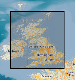
SCANNED IMAGE
Type of resources
Topics
Keywords
Contact for the resource
Provided by
Years
Formats
Representation types
Update frequencies
Scale
-
Scanned images of primary Geological Data resulting from deep underground coal exploration and exploitation. Collection of data includes reports, interpretations and records of research in British coalfield areas deposited by the Coal Authority. Data for past and current collieries and for future prospects. The majority of the collection was deposited with the National Geological Records Centre by the Coal Authority in July 2001. The collection includes borehole site plans, borehole logs , analyses and geophysical data etc. A large percentage of this data will eventually be linked to existing collections.
-

Manuscript geological maps produced by the Survey geologists or other recognised geologists on County Series (1:10560) and National Grid (1:10560 & 1:10000) Ordnance Survey base maps of Great Britain. A small number are produced at larger scale. Similar maps compiled from other sources. Maps produced since the 1850's, current holdings over 35,000 maps, all now scanned and available internally as image files.
-

This dataset comprises scanned images of the manuscript geological maps produced by the Survey geologists or other recognised geologists on County Series (1:10560) and National Grid (1:10560 and 1:10000) Ordnance Survey base maps. The collection also includes similar maps compiled from other sources. Currently the dataset contains over 35,000 scanned images. Original maps date from the 1860s, and cover surveys in Great Britain, scanning started in 2003.
-

Geological map 'Standards', manuscript and published maps of Great Britain produced by the Survey on County Series (1:10560) and National Grid (1:10560 & 1:10000) Ordnance Survey base maps. Maps produced since the 1860's, current holdings over 41,000 maps, all now available internally as image files.